Projects
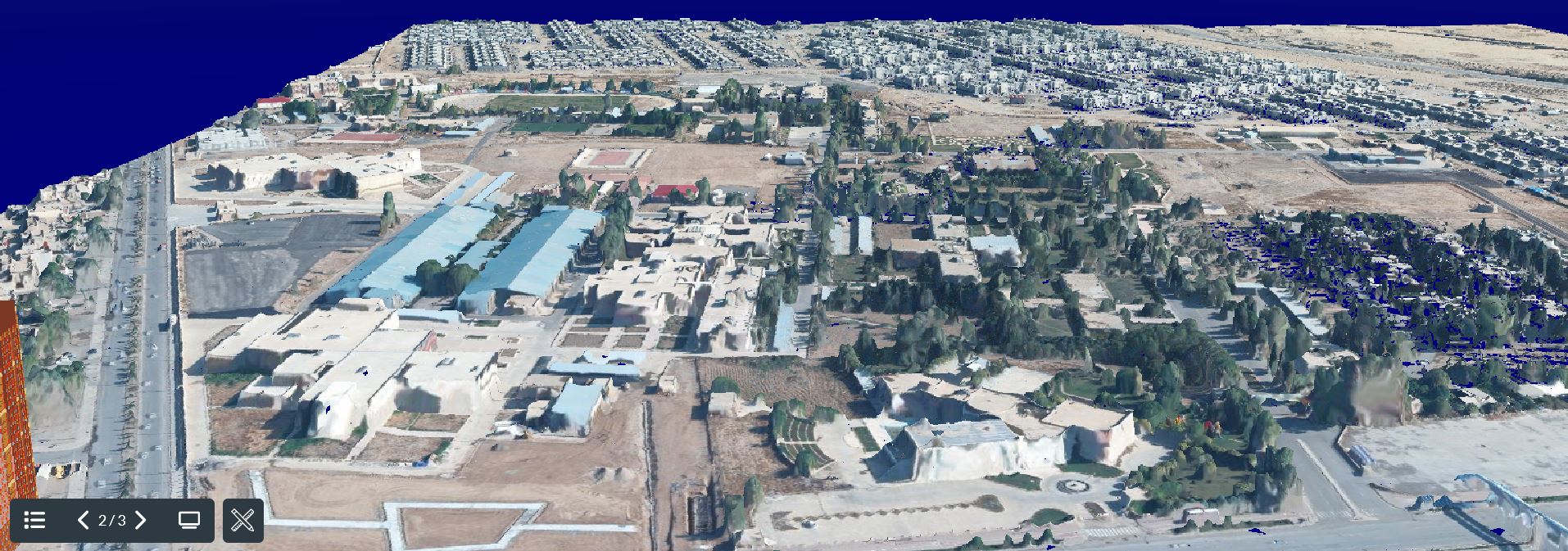
3D-ERBIL (VIRTUAL MODEL): This sample is related to generating 3D model via photogrammetry based on using stereo aerial imagery and SGM. The model can be represented in 3D point cloud and mesh mode. The area is specified in College of Engineering Erbil- Iraq. For click here https://3d-erbil.weebly.com/
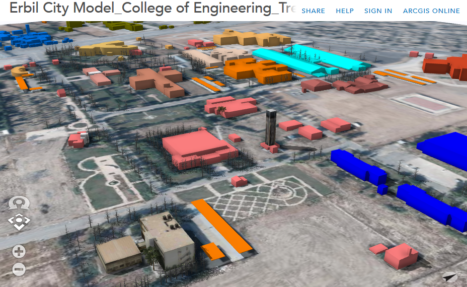
Erbil City Model, this model has been produced for the purpose of the visualization and urban planing. it is based on using photogrammetric technique based on aerial imagery. The model has been used via CityEngine software.
|
|
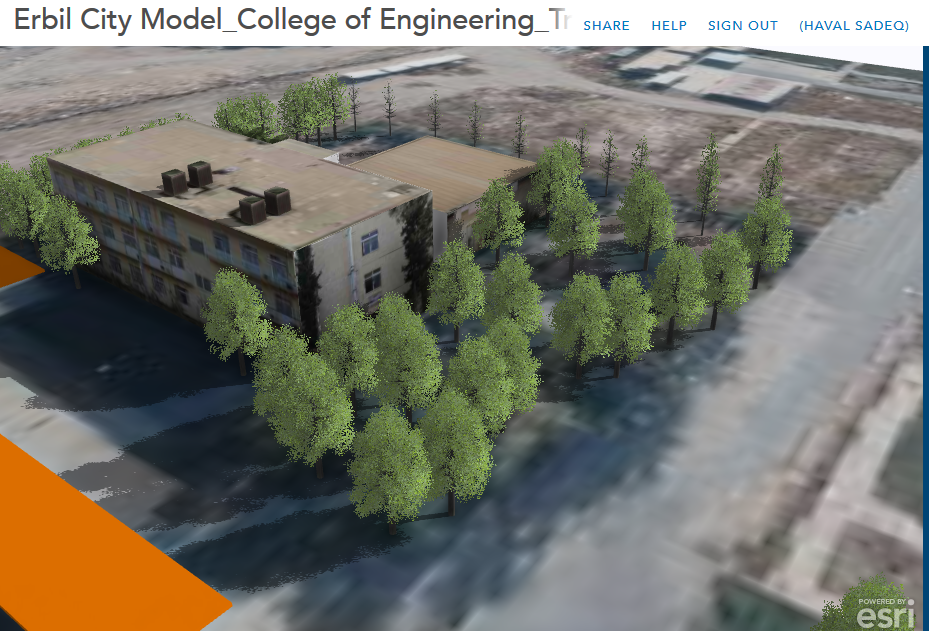
ARCGIS online MAP: This map has been produced in Geomatics Department in College of Engineering at Salahaddin Univeristy-Erbil. The map has been based on using stereo imagery to delineate the buildings boundary via photogrammetry and published on ArcGIS online. It has been produced by Dr.Haval Sadeq. Note: To be able to measure any object you can click here to use measurement tolls.
Assigning PostCODE for IRAQ
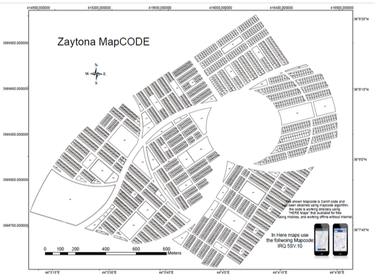
The below project has been achieved, which is related to assign post code in Iraq, the project is based on assign a code for each property so it can be used in the navigation program such as HERE map., for example the code of Geomatics department is "IRQ 56h.cj"
The details of the research can be found in the following link (PDF)
|
|
Using UAV in the mapping
this project is related to use UAV for the purpose of produce DSM and orthopohot over Geomatics Engineering Department-in college of engineering.
this project is related to use UAV for the purpose of produce DSM and orthopohot over Geomatics Engineering Department-in college of engineering.
|
|
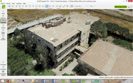
Photogrammetry in Building Documentation
This project is related to using photogrammetry in building measurements based on obtained point cloud. It can be used in the documentation purposes and as built drawings. The paper is available in the following pdf.
This project is related to using photogrammetry in building measurements based on obtained point cloud. It can be used in the documentation purposes and as built drawings. The paper is available in the following pdf.

Plan view for architectural building obtained with photogrammetry.
|
|
|
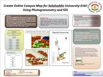
Create 3D model for online map- Salahaddin Univerity-Erbil Campus,
Undergraduate students project, 2017-2018, in Geomatics dep. Salahaddin university-Erbil, under Dr.Haval A.Sadeq Supervision. Click here to download the poster (pdf).
|
|
Validate Data
